
I have this idea that I can't read maps and so whenever possible, I turn them in to written directions. If pressed I can do it but it almost hurts. However I think I give the impression I can read maps and so it was that Gert seemed surprised when I invited him to guide me, my notebook and pencil through some of the Antwerpen walks yesterday.
Many pages of scribbled notes were made as he struggled to read the badly-scaled maps which gave me hope that finding my way around Rome alone wasn't some kind of bizarre fluke and merely confirmed the Lonely Planet make maps most people can use. I don't know, personally I like to look down at instructions that read 'left onto Hoogstraat, next right onto St Jansvliet etc ... it's my preference when driving too.
Bruges is simpler, although the map I use there is just as badly scaled as my Antwerpen one but there's some kind of natural flow thing that goes on there. I haven't worked out whether it's the other tourists and their maps leading the way or the fact that the Bruges walking map follows some kind of naturally occuring route of alleyways and squares.
To make things more complicated, left and right has always been guided by the small faint l-shaped scar on my left hand ... imagine me learning direction in Nederlands class. Only I knew why I was smiling as the audio cd played out directions we had to follow on the map in front of us. Naar links and naar rechts are clear, it's just working them out fast enough to get them down on that map when all is in Nederlands.
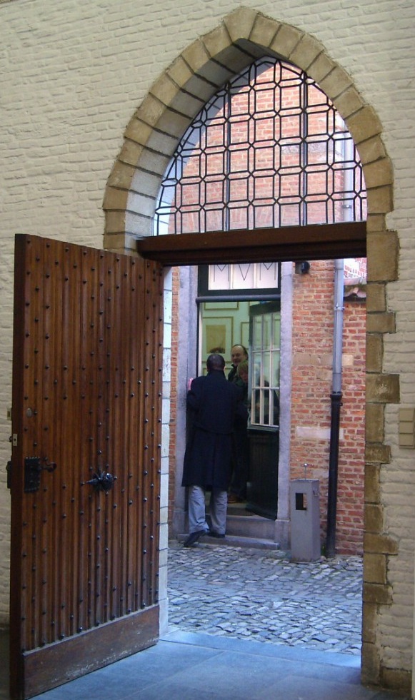
Anyway, enough about maps ... the photographs came from our wanderings. The window is part of the medieval Priory of S. Salvator on Pieter Potstraat and the open door is part of the De Zwarte Panter Art Gallery, situated in the 16th century Sint Julianusgasthuis on Hoogstraat, Antwerpen.
No comments:
Post a Comment